Cableway - AT041
General Information
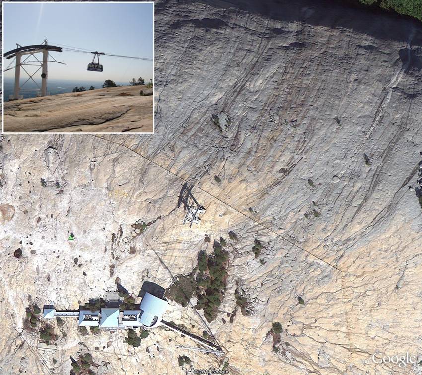
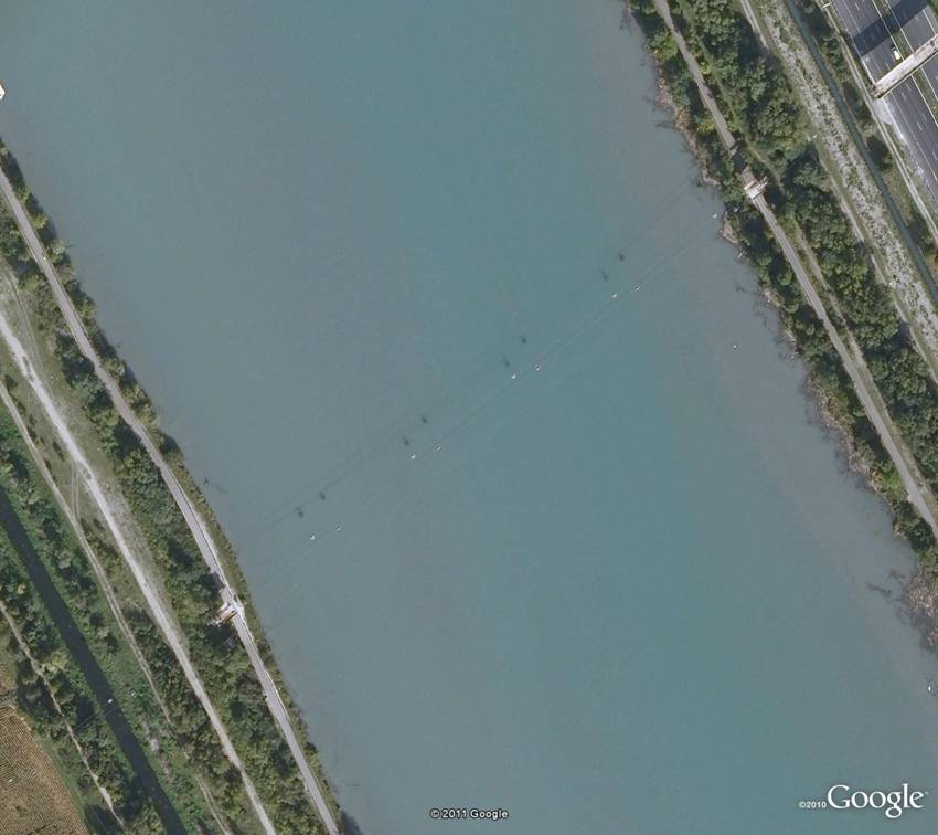
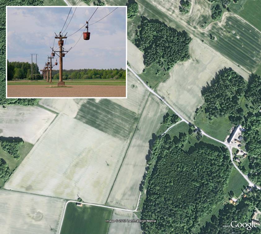
Appearance
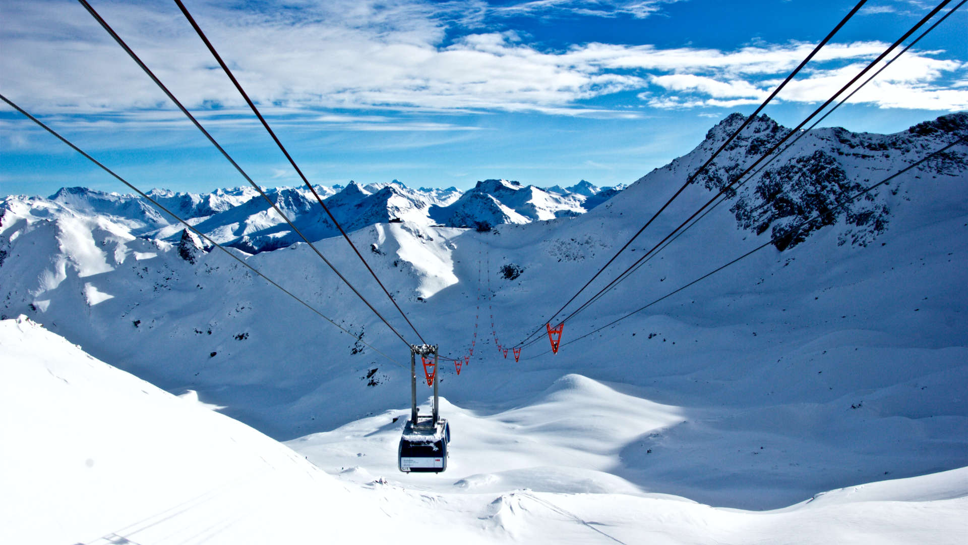
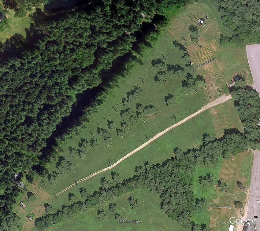
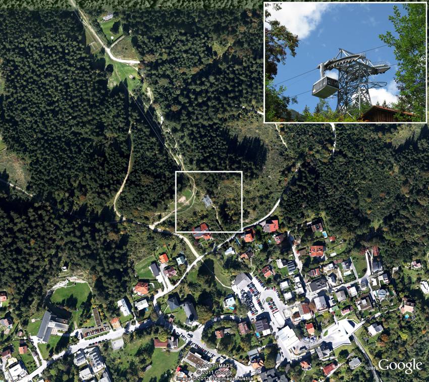
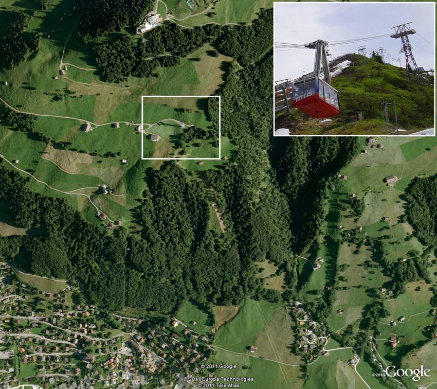
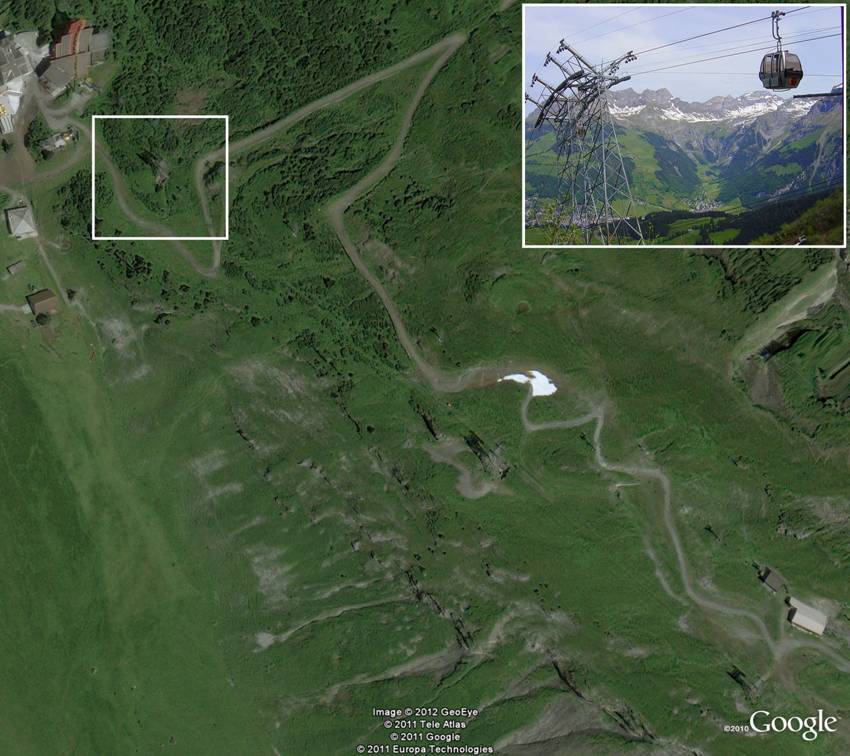
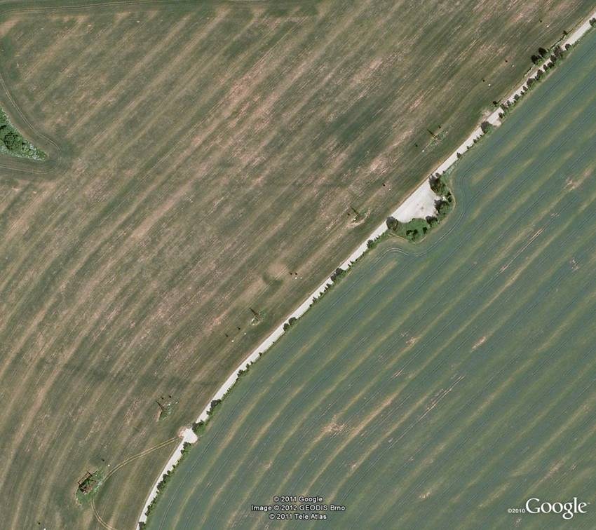
- Recreational (FUC=13). Recreational Cableways extend up the sides of hills and mountains and are found almost exclusively in ski areas. The cables will not be seen but the shadows of the pylons and the carriers may be visible. There may be transportation access at one end of the cableway.
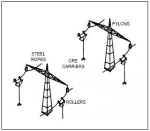
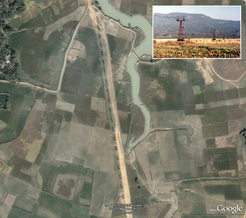
- Transportation (FUC=20). Transportation Cableways are usually found in industrial or urban areas. The cables will not be seen, but the shadows of the pylons (similar to power pylons) and the carriers may be visible. These cableway lines can be differentiated from power lines by the existence of passenger terminals at the ends, or the line begins or ends at freight terminals or industrial plants. In addition, there may be debris lost from the carriers under the route of the cableway.
Associated Features
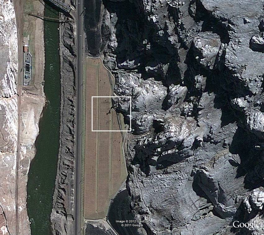
Distinct from Features
Curve Feature Extraction Guidance
Extraction Criteria
Length >=375 m. or Landmark or Height Above Surface Level >= 46 m.
Delineate
Delineate a centre line along the visible extent of the cableway.
Location and alignment of a single Cableway is the centre bottom of the supporting pylons.
Attributes
CAT, FUC, HGT, NAM, NFI, NFN, VOI
General Extraction Information
General Extraction Guidance
If the feature is recorded in a DVOF listing, populate attribution HGT and VOI according to instructions outlined in DVOF/Obstruction Features General Issues.
A cable suspended between two fixed points cannot be broken but may contain one or more vertices along its length.
Additional Information
A Cableway can also be referred to as ‘Aerial Cableway’, ‘Aerial Tramway’ or ‘Teleferic’ on ancillary sources.
NLAdditional Information
Attributes
General Extraction Guidance
Omdat Cableways boven alle andere features hangen, hoeven deze – net als Powerlines – NIET gesnapt te worden; je tekent de lijnen over alles heen.
Additional Information
Informatie in AoI Venezuela
Reference Information
Reference Images
Attribute List
Cableway Type
Definition
The type of a cableway based on structure and/or function.
DFDD Code
CAT
Attribute Type
Codelist
Vertical Obstruction Identifier
Definition
Identification code that uniquely identifies a feature that is a vertical obstruction to low-level flight. ( Although parts of the identifier include digits it can also consist of non-numeric characters. )
DFDD Code
VOI
Attribute Type
CharacterString
Functional Use
Definition
The general categories of function or use that a facility, site, or region serves or may serve. ( May be so designated by legal means (for example: statute, zoning, or treaty) or be the unplanned consequence of economic forces. )
DFDD Code
FUC
Attribute Type
Codelist
Spatial representation of the feature
Definition
Geometric primitive describing the spatial characteristic of the feature.
DFDD Code
GEOM
Attribute Type
GM_Curve
Height Above Surface Level
Definition
The vertical distance measured from the lowest point of the base of the feature at ground or water level (downhill/downstream side) to the tallest point of the feature. ( For non-inland water bodies, the water level is usually understood to be Mean Sea Level (MSL). Note that the feature may be supported above the surface by another feature (for example: a tower supported by a building) and as a consequence the value of the Height Above Surface Level is different (larger) than the base-to-top height of the feature (for example: supported tower) itself. )
DFDD Code
HGT
Unit
Meter
Attribute Type
Real
Name
Definition
A textual identifier or code that is used to denote a feature.
DFDD Code
NAM
Constraint
0 tot 80 Characters
Attribute Type
CharacterString
Named Feature Identifier
Definition
The unique named feature identifier element in the NGA Geographic Names Data Base (GNDB). ( Typically used together with Attribute: 'Name Identifier' to provide a unique index into the NGA Geographic Names Data Base (GNDB) from which NGA draws all of its feature name information. )
DFDD Code
NFI
Constraint
0 tot 18 Characters
Attribute Type
CharacterString
Name Identifier
Definition
The unique name identifier element in the NGA Geographic Names Data Base (GNDB). ( Typically used together with Attribute: 'Named Feature Identifier' to provide a unique index into the NGA Geographic Names Data Base (GNDB) from which NGA draws all of its feature name information. )
DFDD Code
NFN
Constraint
0 tot 18 Characters
Attribute Type
CharacterString